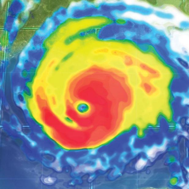
Rainfall of 6-10 inches from Harvey projected for Tri-City area
Harvey regained tropical storm strength as it drifted in the Gulf of Mexico toward Texas early Thursday and forecasters said it could become a hurricane.
The biggest threat that the Morgan City area will probably see from Harvey is rain, with 6 inches to 10 inches projected for the Acadiana region and higher totals possible in some areas, said Seth Warthen, meteorologist at the National Weather Service’s Lake Charles office.
Rain from Harvey could show up as early as Friday in the Morgan City area, with rain probably becoming more widespread by Saturday, especially if the storm drifts farther north and strengthens more than anticipated, Warthen said.
The region further east toward the lower Mississippi River Valley is expected to see 4 to 6 inches of rainfall, he said.
Landfall could occur near Corpus Christi, Texas, Friday night or Saturday morning “potentially as a Category 1 hurricane,” Warthen said.
After making landfall, Harvey is projected to stall in the Corpus Christi area for a few days, he said.
“What it does after that is kind of up in the air,” Warthen said.
St. Mary Parish shouldn’t see the brunt of the winds from the storm, but the region may see coastal storm surge 1 to 2 feet above the predicted tides from Cameron to the mouth of the Atchafalaya River, Warthen said.
“We might see a little of extra wind gust but nothing too intense, not anything like what they’re going to get down in Corpus Christi,” Warthen said, referring to the Tri-City area.
A hurricane warning was issued for the Texas coast Thursday morning, covering an area from Port Mansfield to Matagorda.
The storm’s maximum sustained winds had increased to near 60 mph (95 kph). The U.S. National Hurricane Center said additional strengthening was expected and Harvey could become a hurricane by Friday, when it’s expected to approach the southern Texas coast.
But the intensity forecast is somewhat uncertain, Warthen said.
As of 7 a.m. CDT, the storm was centered about 335 miles (540 kilometers) southeast of Port Mansfield and was moving north-northwest near 10 mph (17 kph).
In Texas, Gov. Greg Abbott has ordered the State Operations Center to elevate its readiness level, making state resources available for possible rescue and recovery actions. Abbott also pre-emptively declared a state of disaster for 30 counties on or near the coast to speed deployment of state resources to any areas affected.
Emergency officials Wednesday asked residents along the upper Texas coastline to move or prepare to move inland. Those in low-lying areas were urged to seek higher ground, and those elsewhere were told to monitor official announcements closely.
On South Padre Island, people filled sandbags and loaded them into cars and vans Wednesday to take to protect exposed homes and businesses. Others in the forecast path of the storm sought out generators, plywood and other goods from hardware stores. Meanwhile, rice farmers in coastal Matagorda County moved quickly to harvest their crops.
