The Daily Review/Bill Decker
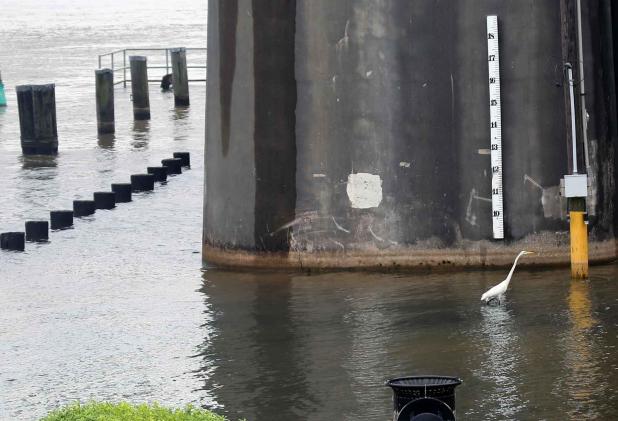
An egret wanders past a gauge on the Morgan City riverfront last week, when what would become Hurricane Barry made its way into the Gulf of Mexico from the plains of Missouri.
Jim Bradshaw: From Kansas City to Morgan City, Barry took long, strange trip
Barry was a strange little storm. I’ve never seen anything like it in the 50 years I’ve been watching and reporting on hurricanes.
Over those years I have always been fascinated by their power and often by their whimsy. They go where they want to go and do what they want to do, no what the experts and their computers say.
I’ve seen them loop around in circles, bounce inland and offshore and back again, suddenly get stronger, suddenly get weaker, do all sorts of unexpected things.
But I’ve never seen one like Barry. He got everything backwards.
To begin with, hurricanes are supposed to begin in a swirl of wind sweeping off the coast of Africa, or in a hot pocket in the Caribbean or Gulf of Mexico. They are supposed to move from south to north.
But Barry’s beginnings weren’t in the western Sahara, or off the Yucatan Peninsula. Barry first got on the weather map as a cluster of thunderstorms in Kansas City, for gosh sakes. Hurricanes aren’t supposed to start there.
That’s why the guys who watch the tropics were looking the other way while the stormy little system moved east to St. Louis over the Fourth of July weekend, and didn’t pay that much attention when it began to curve toward the south.
The storm that would become Barry was near Nashville on July 6 when some of the computer models began to come up with the crazy suggestion that it might turn tropical. The idea began to look not so crazy as the thunderstorms held together and curved south toward Atlanta. By then those screwball computers were tracing a curved path through the South toward Tallahassee, and then into the Gulf Mexico.
That was unprecedented in modern hurricane history, and was scary. The Gulf of Mexico was as hot as it’s ever been, filled with abundant heat energy to feed even a halfway organized storm from the North.
But even if the storm watchers had become believers, but they still weren’t sure what to believe in. They began to predict a hurricane in the Gulf, and even formed a pretty good idea of where it was likely to go. But they were still guessing about how well organized the storm would become and what kind of weather it would bring.
There were dire predictions that levees in New Orleans would not be able to stand the combination of an already-high Mississippi River and a hurricane surge from the Gulf. Those became shriller when the computer models began to send Barry to the river’s mouth and then almost due north.
Then came predictions that Baton Rouge would linger in the wet east side of a slow-moving storm and see flooding worse than 2016.
But Barry had some problems. It seems that a storm from Kansas City has to grow up quickly or not at all. Barry didn’t pass over a long stretch of Atlantic, picking up strength and getting itself organized. It punched its way overland, and was neither strong nor well organized by the time it reached the Gulf.
It did meander slowly toward the west when it finally hit hot water, giving itself time to build into a Tropical Storm, but then it ran into a wedge of dry air that tempered it some. That wedge also kept it from coming ashore just where it was supposed to. Barry passed the river’s mouth; there was no surge in New Orleans. It continued west; the rain and river levels were far below predictions in Baton Rouge.
Barry finally grew just enough to be called a hurricane for all of three hours, just as it came ashore at Intracoastal City, well to the west of where it was supposed to go. But it quickly lost its windy punch. Rain was the issue as it moved through southwest Louisiana and began to head back to the north. Once it moved inland it dissipated pretty quickly into a disorganized cluster of thunderstorms reminiscent of its beginnings.
But there was still enough of it to track over the next several days. And where was it heading?
Kansas City.
Barry was trying to make even more history by making a full circle and going home again. It didn’t get there, but surely did try.
A collection of Jim Bradshaw’s columns, “Cajuns and Other Characters,” is now available from Pelican Publishing. You can contact him at jimbradshaw4321@gmail.com or P.O. Box 1121, Washington LA 70589.
