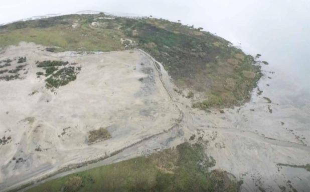
This photos shows land near T-Pat island that has been built with dredged material from the Atchafalaya waterways.
Port of Morgan City Photo
Dredged sediment becomes new land on St. Mary's coast
FRANKLIN – After a handful of tough years, when the Atchafalaya River often ran high and federal dredge funding came in trickles, the Port of Morgan City has found something to build on.
Along with funding through the Army Corps of Engineers and the work of various dredging companies, the port has managed to turn dredge material into new coastal land, port Executive Director Raymond “Mac” Wade told the St. Mary Parish Council on Feb. 23. That occurs at a time when Louisiana coastal loss is a major environmental concern
Wade has been making the rounds at local government meetings recently, reporting on happenings at the port.
Since at least 2015, Wade’s periodic reports have had to include gloomy news about commercial waterways narrowed and clogged by sediment.
This year, he can talk about a higher-than-usual appropriation of $16.3 million in the federal budget for local waterways, plus another $33.1 million in post-budget work plan funding for the Corps of Engineers.
The result has been a lot of dredging. Up to four dredges at a time were working in local waterways late in 2021. They included the Brice Civil Constructors dredge, agitating and removing fluff mud in the channel between Eugene Island and the sea buoy; the dredge Alaska working in the Crewboat Cut area; and the dredge Capt. Frank working in Berwick Bay.
The result, Wade told the Parish Council, is that the port channel from Crewboat Cut to Eugene Island is 400 feet wide and 22-23 feet deep, and 250 feet wide and 22-30 feet from Eugene Island to the sea buoy. The authorized dimensions are 400 feet wide and 20 feet deep.
“We finally got us a channel …,” Wade said. “It’ll help our fabrication yards and help bring some business.”
And, answering a question that came up during his reports to the Morgan City and parish councils, Wade said Bayou Chene will be dredged for the first time since 2009, probably in late summer.
Wade’s report wasn’t just about dredging sediment from channels. It was about what has been done with the sediment.
The sand and silt, millions of cubic yards of it, have been used to build up land over the years in places like New Bird Island, T-Pat Island and the area below Shell Island.
Taken together, the newly created land amounts to 12,000 to 15,000 acres, or 19 to 25 square miles.
Claire Davis-Wheeler, a post-doctoral research erat Tulane, wrote on the university's website that Louisiana loses about that much coastal land each year. The U.S. Geological Survey estimates the loss since the 1930s at more than 2,000 square miles. Terrebnnne Parish is one of the hardest-hit areas, leading to talk about a possible sediment pipeline from the Atchafalaya zone to our neighbor to the east to rebuild coastal land there.
But Wade told the council Wednesday that such a project could cost $350 million. The Bayou Chene Flood Control Structure, now nearing completion, costs less than a quarter as much and took decades to become reality – and then only after a series of expensive floods beginning in 2011.
Meanwhile, the Atchafalaya and Wax Lake deltas are rarities talong Louisiana’s coast in that land is being renewed, thanks to sediment diverted along with water from the Mississippi River into the Basin system.
The biblical overtones of separating the land from the waters were not lost on the council. At one point after Wade’s presentation, a councilman asked legal counsel Eric Duplantis whether an ordinance up for a passage vote could be amended. That ought to be possible, Duplantis replied.
“We just heard a man turn water into land,” he said.
