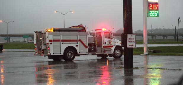
A firetruck with red lights flashing served as a tornado warning at midday Wednesday near the Franklin exit from westbound U.S. 90.
The Daily Review/Bill Decker
(Updated) Storm downs trees, power lines
The St. Mary Parish Sheriff’s Office reported that a power line fell across Southwest Boulevard in Bayou Vista between Canal and 182, and a large tree blocked La. 182 between Centerville and Garden City during Wednesday's storm across St. Mary Parish.
A tree also fell down on Ditch Avenue in Morgan City.
A sheriff’s deputy reported hail in the Patterson area on U.S. 90 near the American Legion hall.
Several areas in the Tri-City area had high water and experienced power outages to the storms. As of 5:15 p.m. Wednesday, Cleco reported 466 customers were without power in St. Mary Parish.
A flood watch is in effect for areas including St. Mary Parish from mid-day Wednesday through Thursday morning, according to the National Weather Service.
Showers and thunderstorms will increase significantly with severe thunderstorms and flooding possible as strong low pressure advances
east across the plains and into the Mississippi Valley.
A cold front will then sweep eastward across Southwest Louisiana Wednesday night, likely accompanied by a squall line with additional heavy
rain. Bursts of torrential rain could lead to flash flooding, especially given lingering moist grounds from heavy rains over the
past weekend.
A wind advisory is also in effect until the afternoon and early evening hours. Sustained winds of 20 to 25 mph with gusts over 30 mph should be expected. Winds are expected to subside inland tonight, but will remain elevated along the coastal counties and parishes behind the cold frontal passage.