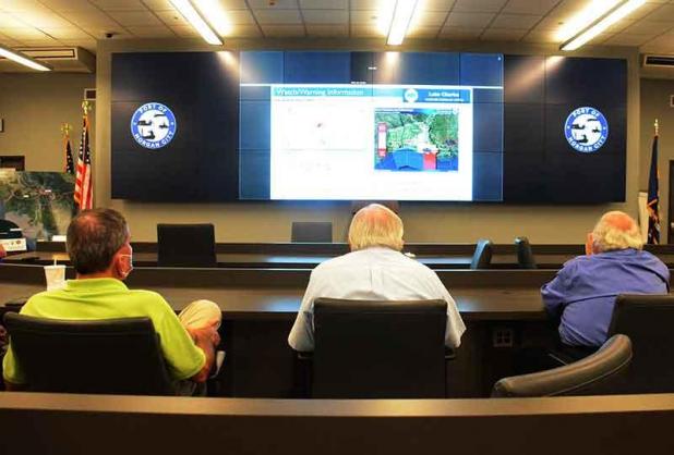
Patterson Public Works Director Steve Bierhorst, Berwick Mayor Duval Arthur and Morgan City Councilman Lou Tamporello watch the National Weather Service 10 a.m. briefing on Tropical Storm Zeta Tuesday at the Emergency Operations Center in Morgan City. (The Daily Review/Geoff Stoute)
Hanagriff: St. Mary in a good position for Zeta
St. Mary Parish is in a good position with Tropical Storm Zeta approaching, but parish officials still are keeping a watchful eye on the storm, Parish President David Hanagriff said after the National Weather Service’s 10 a.m. briefing Tuesday.
Hanagriff said he would not be calling any voluntary evacuations at this time. However, if it stays on its current track, Hanagriff said he could issue a voluntary evacuation in areas south of the Gulf Intracoastal Waterway later Tuesday after the 4 p.m. briefing.
He also said he doesn’t think there will be major waterway closures, adding the Bayou Teche will not be blocked with sheet piles where a future gate will be, but Hanagriff said some gates may be closed. He said more information will be forth coming after the National Weather Service’s 4 p.m. briefing.
As for Zeta, the tropical storm watch extends from Intracoastal City to Morgan City. It includes St. Mary and Lower St. Martin Parishes. The storm’s impacts in St. Mary and Lower St. Martin parishes are anticipated to be tropical storm force winds and 2 to 4 inches of rain, Andy Patrick of the National Weather Service’s Lake Charles office reported.
Patrick said four inches could be anticipated on the “extreme southeast side of St. Mary Parish.”
A storm surge warning also has been issued for the areas from Intracoastal City to the Mississippi/Alabama line.
Storm surge for coastal south central Louisiana could be 2 to 4 feet at high tide late Wednesday.
As of 10 a.m. Tuesday, Zeta was along the Yucatan Peninsula’s coast and expected to enter the southern portion of the Gulf of Mexico soon.
While it has decreased in strength down to 65 mph, warm water in the southern Gulf will enable it to strengthen into a hurricane later Tuesday, Patrick said.
By Tuesday night, Zeta is expected to begin its north movement with a northeast turn expected in the northern Gulf of Mexico.
A cold front projected to reach the southwest Louisiana area could help the storm move even more to the northeast.
Zeta is expected to make landfall Wednesday evening as a Category 1 hurricane in southeast Louisiana, and a hurricane warning is in effect east of Morgan City to the Mississippi/Alabama border.
There is a 20% to 40% chance of tropical storm force winds of 39 mph or greater Wednesday for the coastal areas of south central Louisiana from Vermilion Bay eastward.
Winds reaching 58 mph are not expected on land, though.
In St. Mary or Lower St. Martin parishes, tropical storm force winds are anticipated to begin Wednesday between 9 a.m. to noon and end Thursday between midnight and 3 a.m.
Patrick said there could be a 12-hour period where there are tropical storm force winds, but they shouldn’t persist for the entire time.
“We don’t anticipate it to be a full 12 hours of that, but we do expect potentially some period, probably in the late afternoon or evening, where the winds will probably be the highest,” Patrick said. “Then we’ll start tapering off during the late evening.”
